
~Ben Nevis~
14th October 2012
Naggers of Conscience! How many times have I been to or through Fort William and wondered about life at the top of Ben Nevis? Nearly always in cloud, it seemed; could we find a fine day out of the two available for an ascent of the highest mountain in Great Britain?
Ben Nevis Summit
Scroll down for photos and a description of the walk....
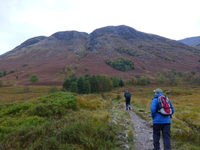
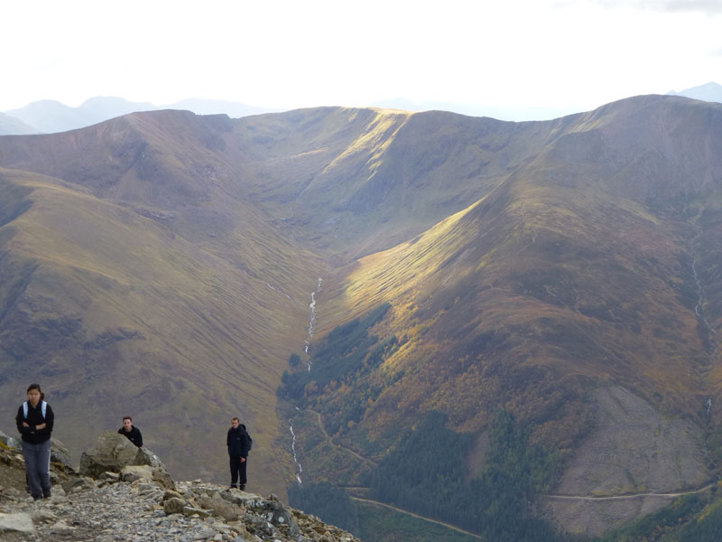
Three Mountaineers
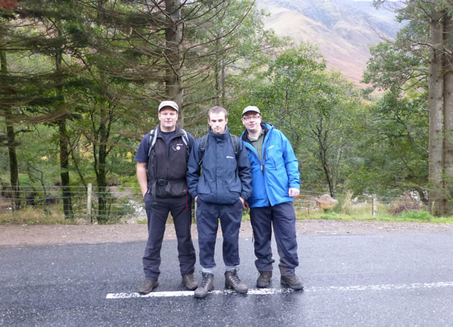
We planned to ascend "The Ben" on Saturday 13th, but the cloud level was too low and the mountain weather forecast discouraging. So, after an early breakfast at the B&B, we drove round to Glen Nevis and parked on the roadside near to the Youth Hostel. With a long day ahead, it was decided to start from as near as possible to our intended target. That's me, son Andrew and brother, Peter.
Ben Nevis
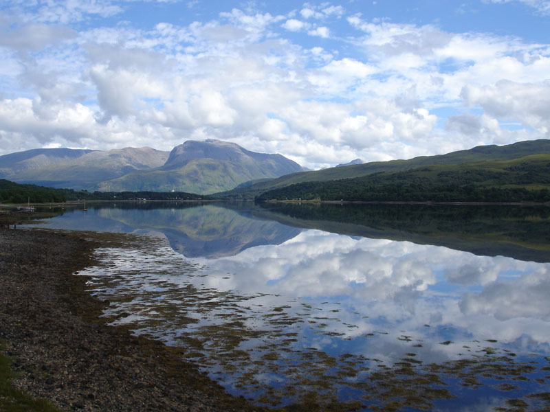
Here's one I took a few years earlier. If you climb Ben Nevis from the foot, you can't take any photos of the mountain - indeed the main bulk of the fell cannot be seen from Fort William.
 |
 |
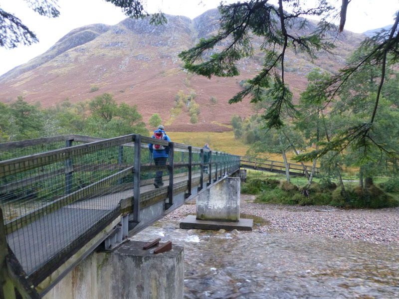
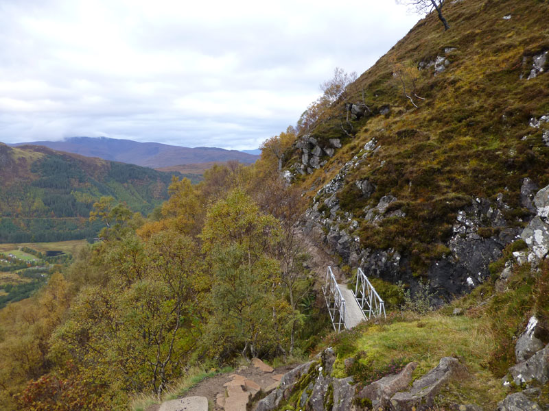
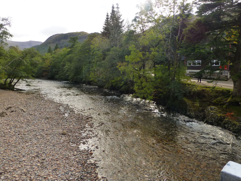
Footbridge over River Nevis |
The Start of The Walk |
 |
 |
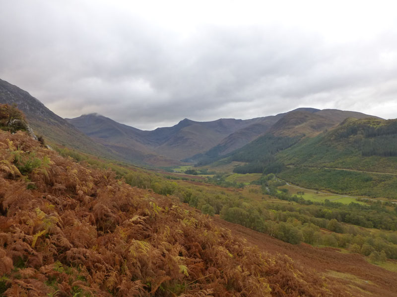
Glen Nevis |
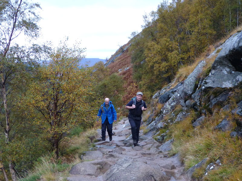
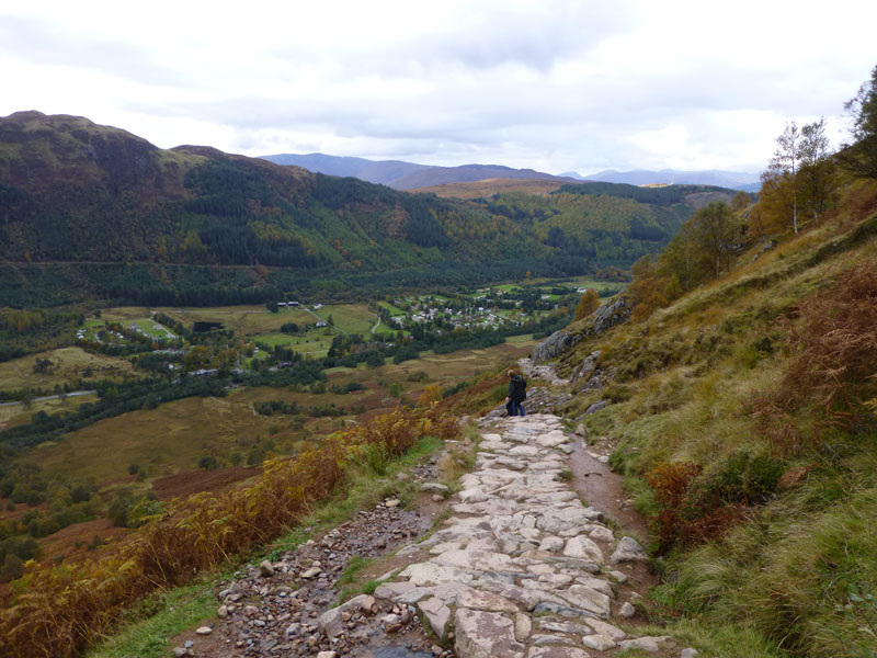
Well-Maintained Path |
Early Stages
There is no shortage of safety information available for a Ben Nevis climb. Estimated times were given at between seven and nine hours (from Glen Nevis car park). I had read and was carrying a leaflet entitled "Navigation on Ben Nevis" published by The Nevis Partnership and given out free at various places.
The "Tourist Path"
Our route is the popular way up for all and sundry. Today, with our start time of 08:20hrs, we are ahead of the pack. This is the "tree-line", above which there are no more trees. It's 1,000ft above sea level, so just about another 3,409ft to go.
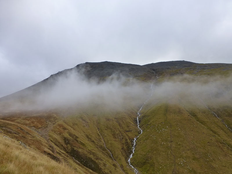
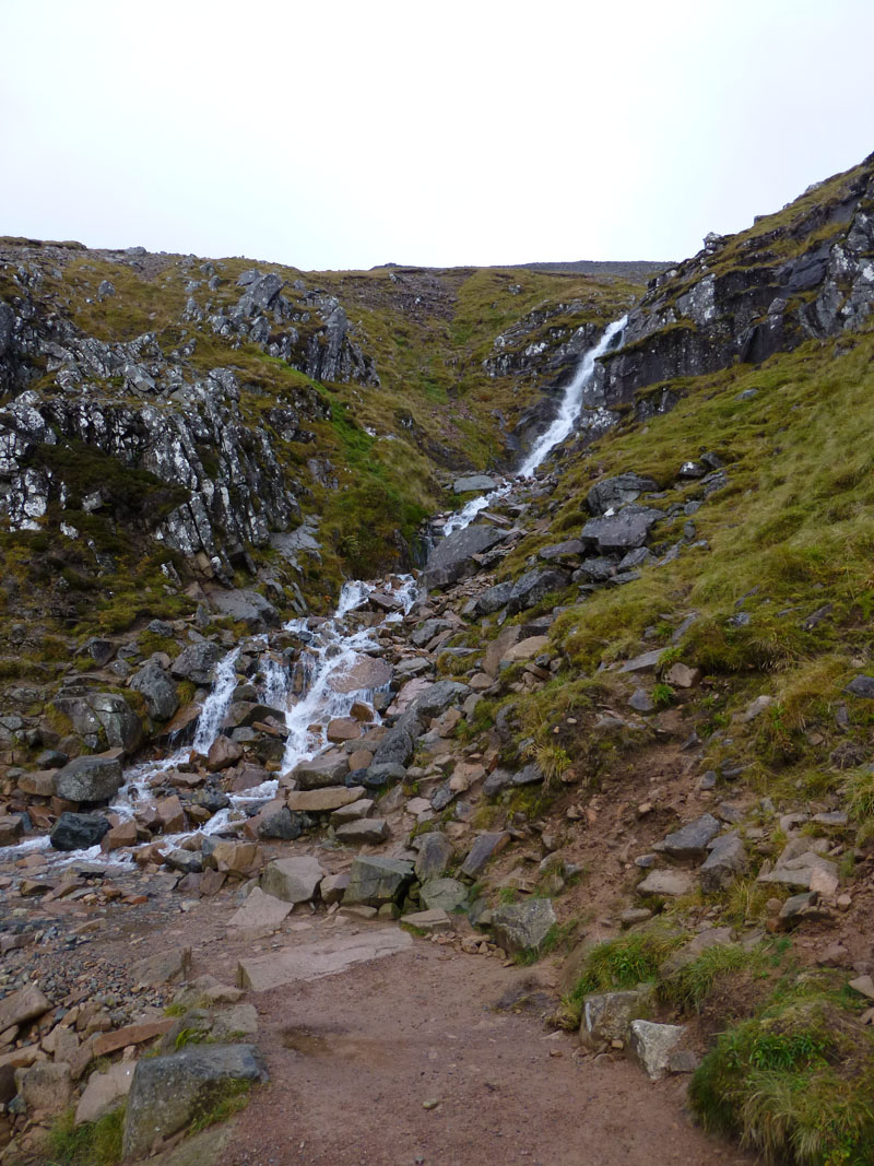
Red Burn
Today, we'll take what's on offer, it has to be better than the previous day. Wispy cloud is drifting around and we think the top is probably in cloud at the moment. Red Burn is in view.
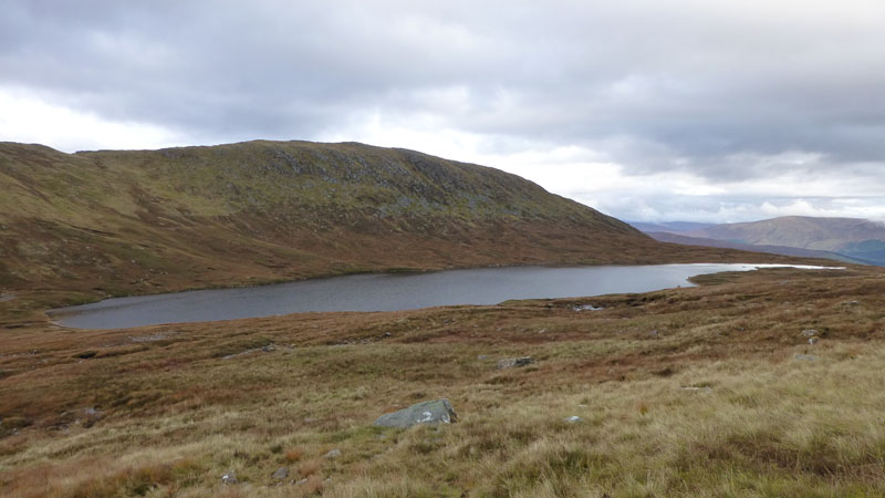
Lochan Meall an t-Suidhe
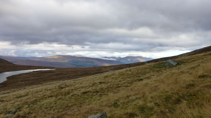
Some may think that reaching the lochan is halfway and cause for minor celebration, but the halfway point is a little further on as the path crosses Red Burn. The view to the north (below) shows two characters heading along the path to the North Face. The forest is that of Glen Loy and the mountains further to the right could be those on the west shore of Loch Lochy.
Looking North
Halfway (nearly)
A psychological benefit of passing the burn is the belief that half the work is done. One hour and 25 minutes after setting off and it's the start of the "zig-zags" - a series of nine, roughly north-east/south-east climbs that draw walkers up from 2,050ft to 4,100ft.
Meall an t-Suidhe
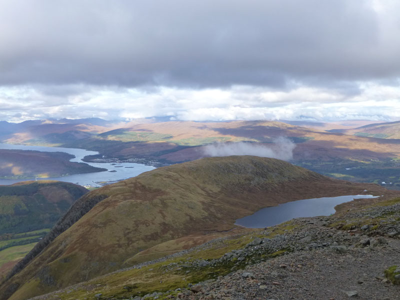
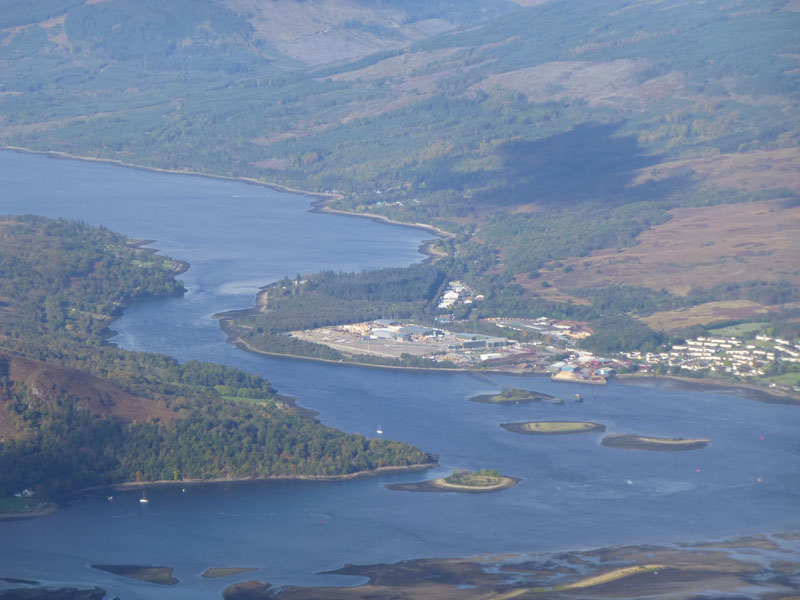
Gaining height all the time, the view to to the north-west is most appealing. Elevating ourselves above the neighbouring hill, as named, reveals "The Narrows", where Loch Linnhe meets Loch Eil - both tidal sea-lochs.
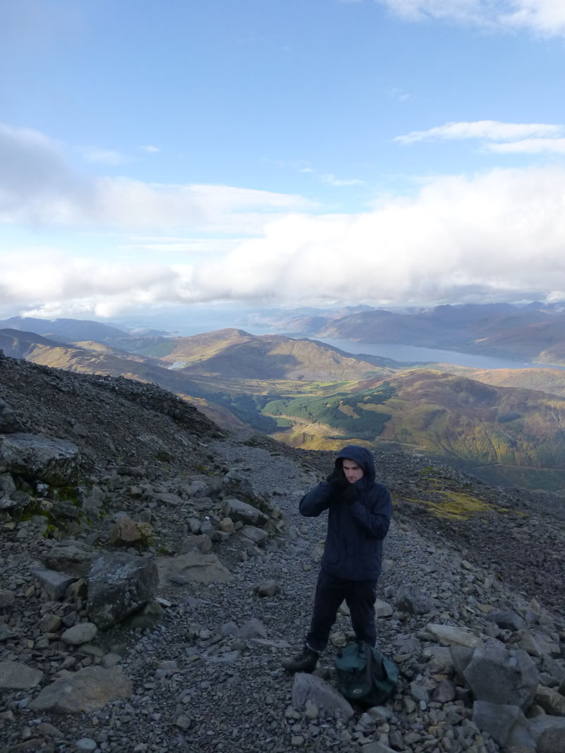
Extra Layers
The temperature falls sharply as height is gained, early descenders have warned us of very cold winds, snow, ice and low visibilty in the cloud. We prepare in the usual way.
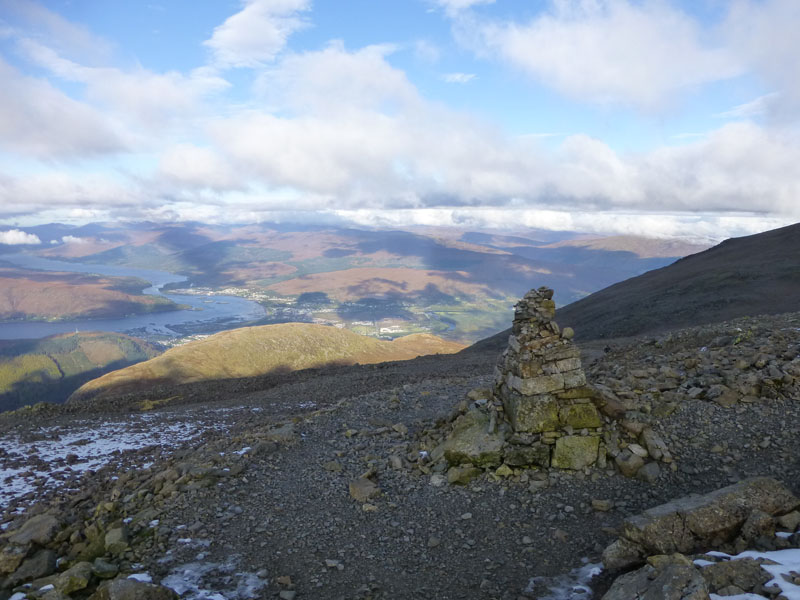
Navigation Aid 3,770ft (approx)
The first cairn we come across is on the corner of zig-zags seven and eight. It has great purpose which will be revealed later.
 |
 |
Looking Down |
Looking Up |
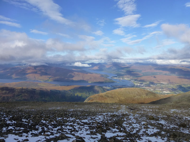
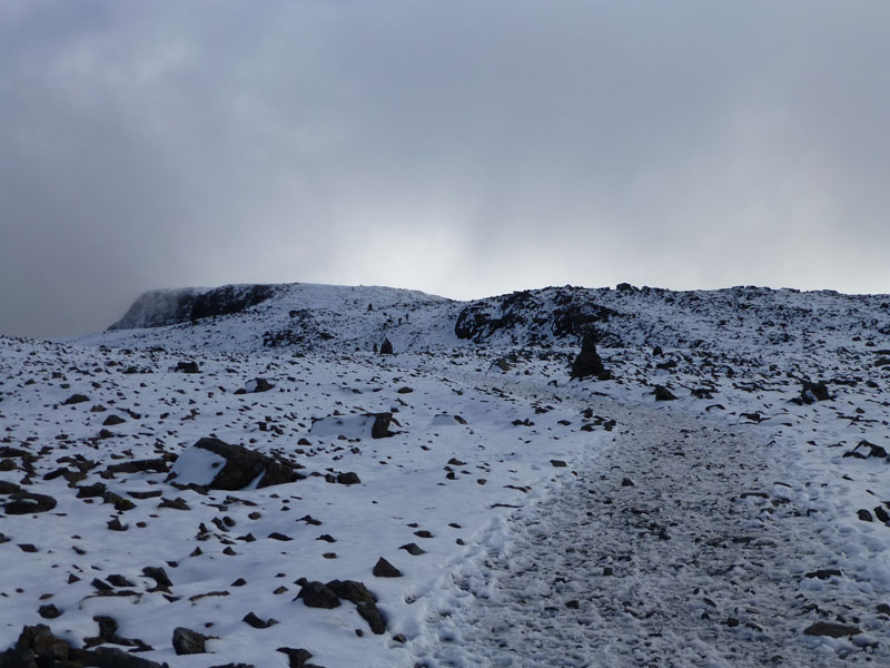
Views from 3,900ft (approx)
The photo on the right was taken two minutes after the one on the left and shows the wintry nature of the recent weather up here. It also suggests that the summit is just clear of cloud.
 |
 |
Peter |
Andrew |
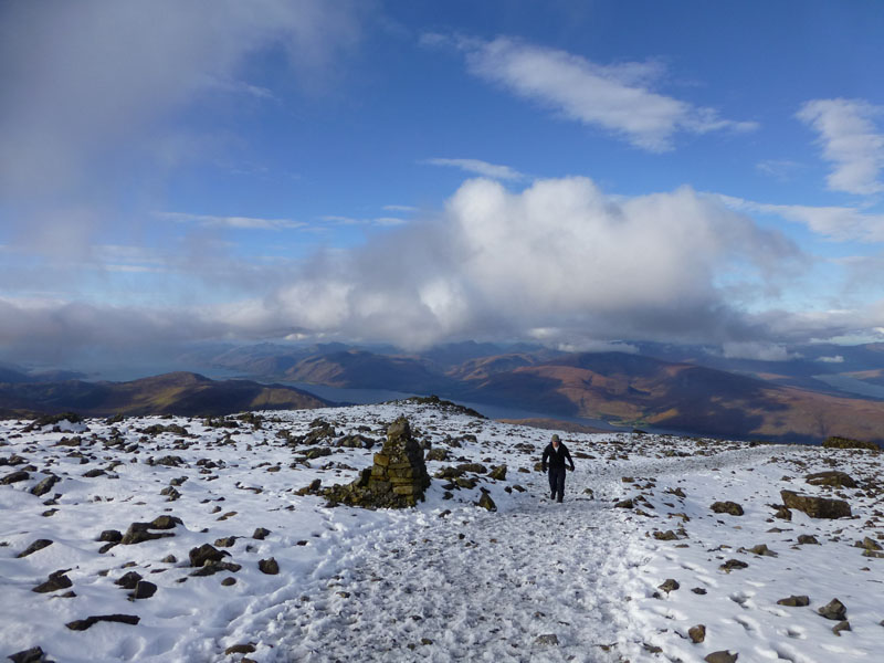
Improving Weather
Again, a few minutes later and it's looking good for the final approach to the summit.
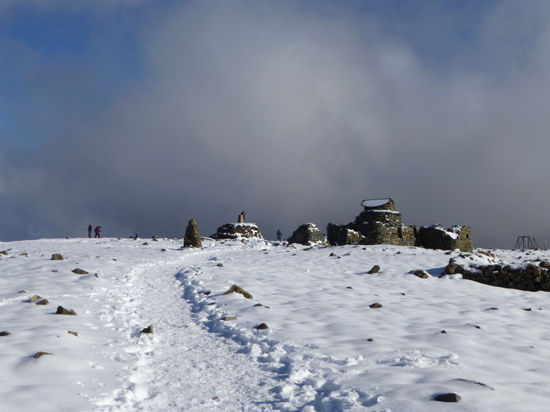
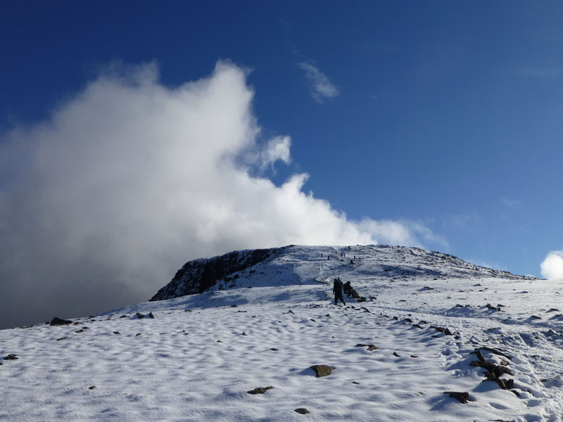
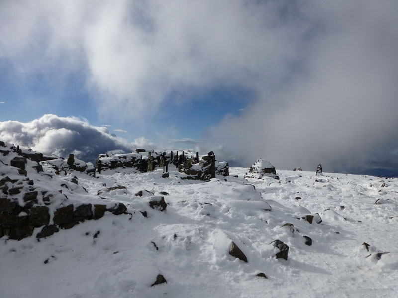
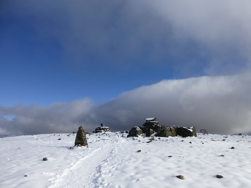
The Cairns
The cairns are aligned to offer help in navigation off the summit in bad weather as the consequences of a wrong move are dire!
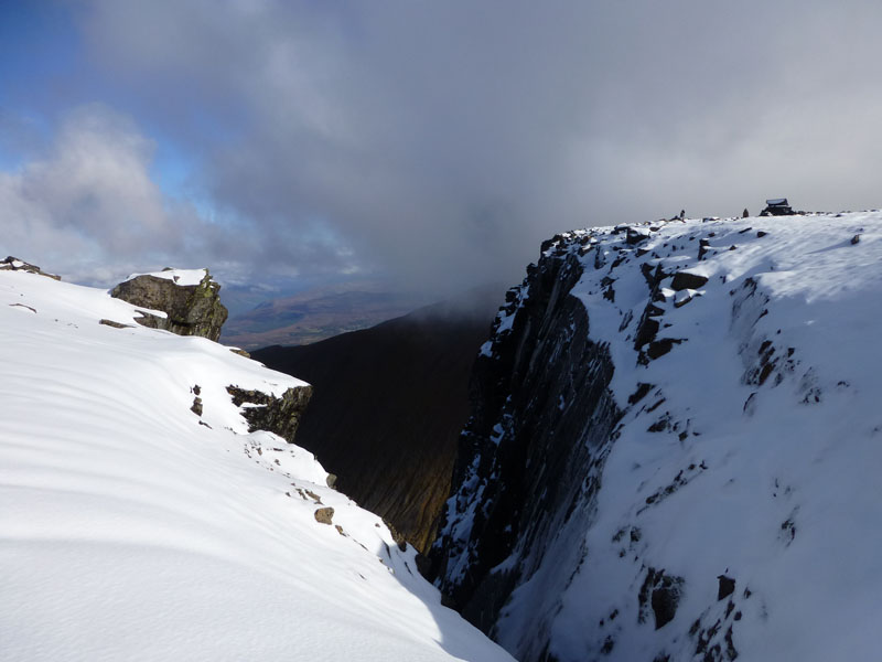
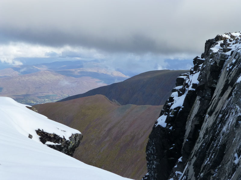
Gardyloo Gully
There is already a cornice building at the top of the gully. "Google" Gardyloo Gully, click "Images" and be amazed by photos of winter climbing by experienced adventurers. Do not try this at home!
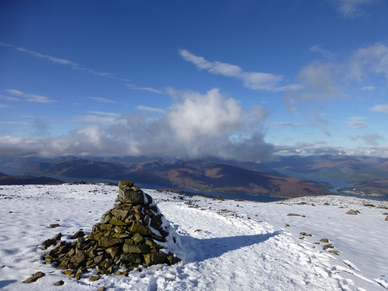
Ben Nevis Summit Territory
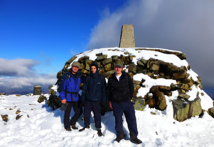
Three hours after standing on the tarmac in Glen Nevis, we are on the summit of "The Ben". There used to be an observatory up here along with a small hotel. The sun is shining, the snow is 12" deep, it's very cold and for anyone, it's a great feeling to be up here.
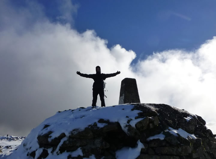
Andrew on top of Ben Nevis
The highest man in Great Britain at 11:20hrs on 14th October 2012. Ordinarily, this young man would still be in bed at this time on a Sunday morning. He beat me by two minutes, or looking at it another way, 28 years.
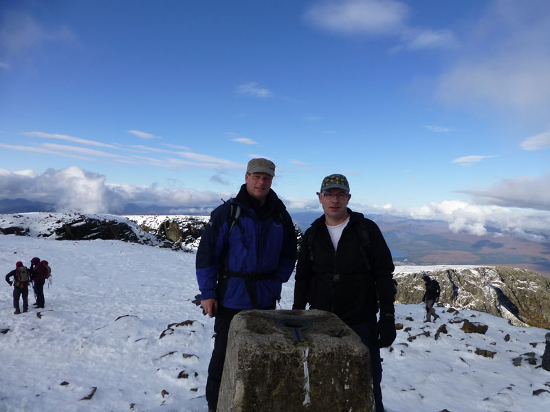
P&R on top of Ben Nevis, 4409ft asl
 |
 |
Ben Nevis Summit Area |
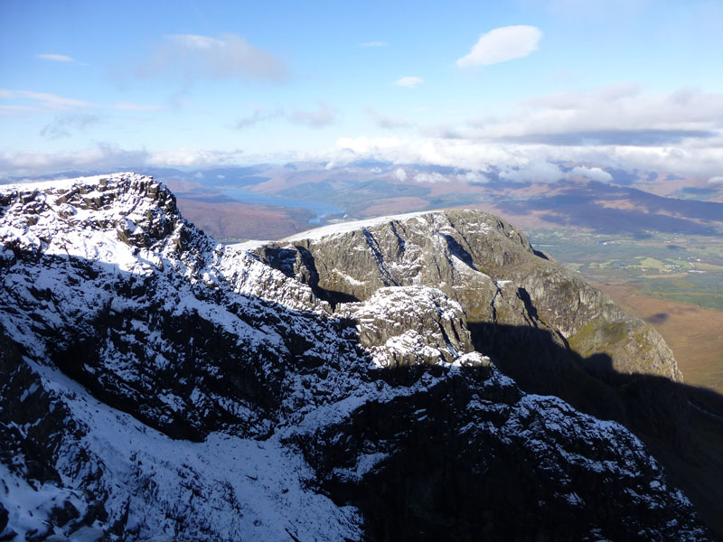
Carn Dearg from Ben Nevis |
 |
 |
The Top |
Mullach nan Coirean |
 |
 |
Carn Mor Dearg Arete and Aonach Mor |
Heading Down |
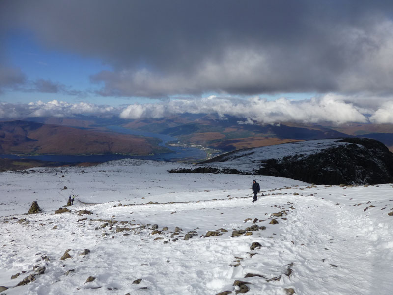
Summit Views
And the time soon came to head down, you may be able to make out the row of cairns in the photo (lr)
Islands of The Narrows
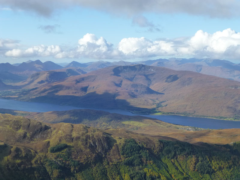
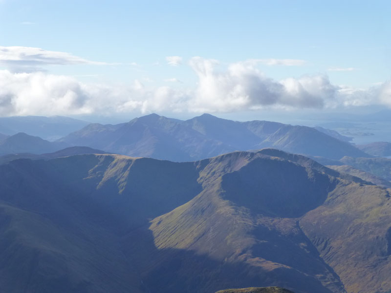
Stob Coire a Chearcaill
The view over Loch Linnie to the west, showing the eastern, craggy face of Stob Coire a Chearcaill.
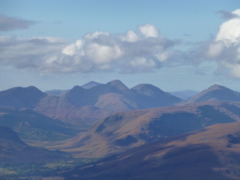
Mountains of Ardgour
This is a zoomed view of the top left corner of the previous photo. I think the high point, left of centre is Garbh Bheinn, 2904ft asl.
Stob Bàn (summit to the right of photo) 3,278ft asl
Much of the descent offered the same view as the ascent, not surprising as it was exactly the same route.
Descending
Back over The Nevis
Six hours after setting off, we cross the bridge and return to the car.
Walkers: Peter, Richard and Andrew Ratcliffe.
Time taken: 6 hours over a distance of about 9 miles. And another six hours or so to get home.
Route: Glen Nevis Youth Hostel, onto the "Tourist Route" up to Lochan Meall an t-Suidhe and across Red Burn and up the zig-zags to the summit of Ben Nevis. Reverse the route back to the car.
Weather and Conditions: Low cloud at the start, improving to sunny spells. Cold on top!
Greetings Count: We were overtaken by one couple on the ascent, we managed to pass quite a few others, some of whom never made it to the top. We passed dozens of late starters on our descent. Apart from the weather, we were glad to avoid the many charity walkers who tend to use Saturday for the Ben Nevis leg of the "National Three Peaks" events. Mad!
Richard's Refreshment Review: We took tea at The Glen Nevis Restuarant. Not ideal for serious walkers, if we had parked at the main car park, we would have visited the Ben Nevis pub at the foot of the mountain. The GNR closes at the end of October, until March 2013.
Three Summiteers!
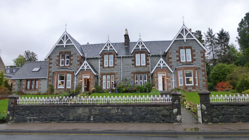
Myrtle Bank Guest House - a good place to stay! Welcomming, clean, comfortable, overlooking Loch Linnie, short walk into Fort William, ample parking, fine breakfasts, attractive garden, mints on the tray in the bedrooms.
All photos copyright Richard Ratcliffe 2012 ©
Contact Me via email - If you don't use "Outlook", just read the email address and send me a message from your usual email facility. Comments might be published, please tell me if you don't want that to happen and I will also edit messages if they contain personal stuff that the world doesn't need to see. Hover your pointer over the link and the target might appear in the bottom left of your screen.
Really enjoyed your account and photos. Well done to you all. Sue S ~~~~~ Hello Richard ~~~~~ Great photos from Ben Nevis. Must have been a wonderful walk - definitely worth waiting for. Jo H ~~~~~ Hi Richard ~~~~~ Well done on your Ben Nevis ascent at weekend Richard. Glad the weather was decent and allowed you to achieve your ambition. You must have enjoyed that one...Some excellent photos of the walk, really enjoyed by us, and a good day made all the more rewarding with Andrew and Peter being with you. A really good family effort. Great photo of the three of you. ~~~~~ Nice one Richard and fantastic to see the snow :o) I agree not worth driving all ~~~~~ Hello Richard ~~~~~ Weel done Richard, and to your brother & son too. You look as if you ~~~~~ Dear Richard, ~~~~~ Hi Richard I enjoyed the pictures and it looked like a good day out on Britains highest ~~~~~ Hi Richard, A brilliant ascent, well done to the three of you. ~~~~~ You did well to climb the Ben on a good day. We have tried frequently and been Anyway, wonderful views and photos and an interesting commentary as we 'climbed' ~~~~~ And four from Facebook... Fab report and photos , you really picked a good day. Andy B Great album Richard, brought back some good memories. Nigel B Loved the photos Richard, I couldn't see a thing when I went up in August years ago. It just goes to show summer isn't always the best time to go up a mountain. Lorraine B A great report Richard, so glad you had a clear top when you got up there, and snow! Gary J |
Take me back to the start ....